Gannett Peak is an interesting mountain to summit. There are a lot of factors to consider when you go for this Wyoming High Point.
There are a few routes to get to the top of this peak. We took the Highline Trail at the Green River Lakes Trailhead to the Tourist Creek Drainage. From there we went up the West Couloir in route to the North Ridge.
This trip was about 55 miles round trip and was quite intense. It took us 3 fairly leisure hiking days in, and 1 and a half strenuous days out.
From the Green River Lakes Trailhead we took the Highline Trail south for about 9 miles. After crossing a foot bridge to something called Beaver Creek Park area, we continued South into some trees for about a mile and cut east out of the trees and into a marshy field.
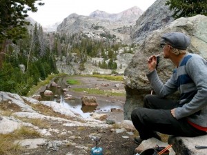
In this field you can see up the Tourist Creek Drainage. You cross the river and head upward. You start ascending the drainage at the south side of the morainne. This is a somewhat gradual slop involving a lot of boulder hopping.The lower Tourist Creek Drainage is fairly narrow and levels out about halfway up. The stream that runs through the lower drainage is mellow at the halfway point and has some great camp spots within the trees.
After you come out of the trees, there are more boulders to hop and some grassy areas. You want to continue on the right (south) side of the drainage and head upward.
Before you know it, you will leave the stream behind and come upon Lake 10090, which was mostly dried up in late August.We stopped here and ate some lunch. Then continued onward. Now in the upper Tourist Creek Drainage. This is where things got confusing for us. The route descriptions were vague and we kind of just guessed our way to the 2nd lake, Lake 11085.
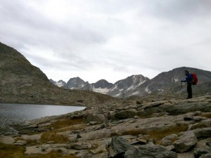
From Lake 10090, we headed east around the south side of the lake, over a small ridge and followed a faint trail that passed a small pond and followed up a mellow stream. We crossed to the South side of the stream and headed South through some bushes and up some rocks into another green valley. We just kept choosing the right-most valley and gained elevation until lake 11085 finally appeared over the last ridge and below the west side of Mount Solitude. This lake was much larger than the first lake and took a little bit of time to get around. We kept heading south around the West side of the lake, and came over another ridge that looked over a small alpine lake and Gannett Peak came into view for the first time.From the descriptions we thought this small lake was Scott Lake, but it’s not. I do not know the name of this small water hole, but we ate some dinner here passing around the north side of this lake and over a small ridge on its East side.
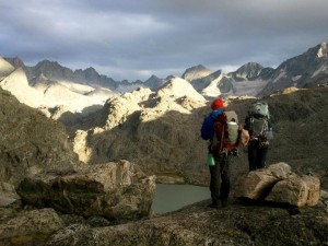
It was here we realized where Scott Lake actually was. Over the small ridge we looked south and down the extra 500 foot cliff to the huge, lake that was the same color as the Green River we had crossed the day before. The milky green looked amazing as the Alpine glow of Gannett Peak showed it’s face directly East. We stayed up above Scott Lake and kept on the shelf heading East past a waterfall, along grassy hillsides, and over another ridge where Skinny Lake came into view. We left the grass and boulder hopped our way towards this lake.As the sun set, we set up camp between Scott Lake and Skinny Lake. We set our alarms early for our summit day that began in the morning.
We woke and ate breakfast, leaving our camp a filled our water at Skinny Lake. We stuck to the South side of this lake heading east. We turned South and headed up the Southeast drainage toward Glacier Minor.
The Glacier looked much smaller than pictures from other routes and so we left our crampons behind and were able to navigate around to the East side of the glacier and below the west face of Gannett.
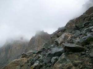
We began up the west couloir when a thunderstorm rolled in and began to down pour. Exposed, we debated that it would be safer to head back, because a class 4 rock climb without rope is sketchy enough when dry.We realized other factors made our choice a good one once we reached Skinny Lake. We were wet and freezing, and a few more hours of hiking may have lead my friend into hypothermia. She did not have a water proof jacket.
We were so close to the top and could see the route up to the notch. Scrambling to the ridge would have lead us to the North Ridge class 4 rock climb section. Heading south you would scramble up this ridge and reach the summit in under 2 hours from where we were.Although I am disappointed that I couldn’t check this peak off, I think we made the right choice and I am excited to try the peak again.
Our way out was a day and half of hiking back the way we came in thunderstorms the whole way out. We were soaked and tired by the time we reached the car, and a diner in Pinedale improved our spirits.
This hike reminded me in every way of Lord of the Rings. The rocks, the grass, the rivers and lakes, and the duration of the hike made me feel like I was on a quest in Middle Earth.
I would recommend this hike to anyone, even if you don’t summit Gannett, the trek to Skinny Lake is amazing!!


You must be logged in to post a comment.