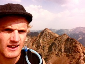
I just did my second solo summit ever and my first climb of Twin Peak the other day, along the Broad Forks trail up Big Cottonwood Canyon just South of Salt Lake City. It was a great hike and I would suggest it to anyone who is just getting into mountaineering. There were a few obstacles I experienced along the way, but it was a very straightforward hike overall.
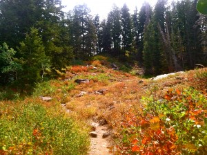
 The hike begins at the Broad Forks trailhead at the S-Curve in the road about 4 miles up Big Cottonwood Canyon. The trail begins fairly gradually uphill through pines and over a stream. After a while, the pines become littered with aspens and low shrubs. Luckily, the heat from the sun had begun to turn the leaves on these shrubs red and gold, making the hike a little more beautiful than I had planned.
The trees clear out and you come across a meadow and basin area, where Sunrise Peak and Dromedary Peak begin to show up directly in front of you (East). Stay left on the trail and you cross a stream over some log bridges and around the North side of a small lake.
You begin gaining elevation a little bit more quickly once you pass the lake, and if you look back you get a nice view of the meadow and few lakes you may not have noticed. The trail continues up along a creek and opens up into another basin below Dromedary and Sunrise Peak with the East Twin peak up over you right should (if you are facing East).
The trail is a little more difficult to follow from here, but you can kind of make out traces of it as you follow the cairns up toward the saddle between Sunrise and East Twin Peak. This is the part of the hike where I got a bit confused. As you ascend up the scree and get closer to the saddle, the rocks get larger, the trail becomes harder to find, and the cairns disappear.
If you just head to the saddle, it won’t really matter which way you arrive onto it. From what I could tell, there were various ways to get to the saddle. I just wasn’t sure if I was going to get stuck if I didn’t follow a specific route. You don’t have to. The saddle is the route to the top, and once you get there, the direction is pretty straight forward.
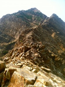
 Once you are on the saddle, you can see little cottonwood canyon on the other side. You will head west up the ridge line, scrambling to stay on top of the ridge, until you reach a wall that you cannot scramble over. From here you will climb a short way down the cliff on the South side of the ridge until you reach a small ledge and a crack the leads up to the ridge that leads to the summit.
This was the most exhilarating part of the climb for me, and even though I was a bit nervous to climb the crack, it was very rewarding once I did so. Once you reach the top of the crack, the ridge line opens up and there is an easy trail that leads to the top through some small pine trees.
 From the top, you can continue West along the ridge line to reach West Twin Peak which is 2 feet shorter than the east peak.
The way back down was filled with contemplation about the hike up and sore joints with the downhill climb. I stepped about 6 inches from a rattlesnake the was hiding under a bush that lined the trail. The sun was about to set as I reach my car back at the road.
Overall, this hike was great for getting me used to some exposure at the top and was good for a solo hike to prepare for larger summits in the future. If you live in Salt Lake Valley, or or visiting for a few days, this hike was great! It took me about 7.5 hours at a moderate pace, and I even got a bit lost heading toward the saddle for about 30-45 mins. Good Luck!!

You must be logged in to post a comment.